


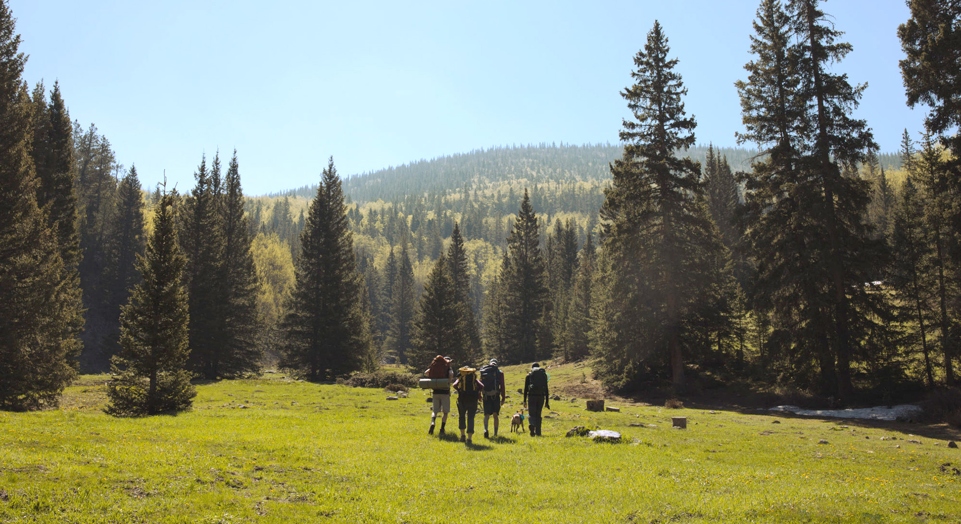
Hiking & Trekking In Questa
Ideally located amidst more than 300,000 acres of protected public lands, Questa offers access to trails in the Carson National Forest, including the Columbine-Hondo and Latir Peaks Wilderness areas, and the Rio Grande del Norte National Monument.
The number of Questa-area hiking trails and walking paths are as countless as the variety of options to choose from. Descend down 800’ into the Rio Grande Gorge, venture along river paths to see ancient petroglyphs and basalt rock formations; hike to the top of Latir peak at 12,700 feet, take the walking path around Eagle Rock Lake, or the Questa History Trail through town.
Be safe: Many hikes are in remote areas with limited cell-phone reception and without readily available emergency services. Wear or take layers of clothing and a hat for changing weather conditions, have plenty of water (more than you think you’ll need), choose appropriate footwear. Always keep pets leashed. Plan well, be safe and enjoy.
Visit the USFS Site for safety tips.
Hikes In The Rio Grande Del Norte National Monument
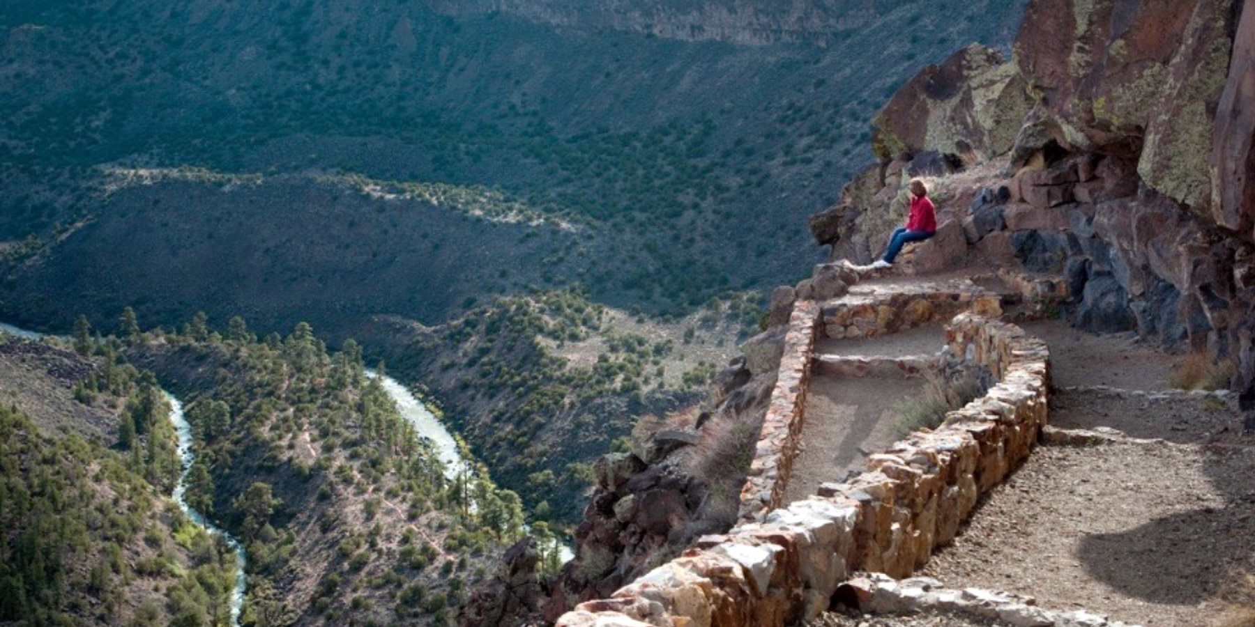
The Wild Rivers area of the Rio Grande del Norte National Monument offers some of the most picturesque overlooks and scenic river access trails into the Rio Grande Gorge.
Chiflo Trail is an easy half-mile in and back trail that leads to the Rio Grande. There are a few benches along the route with great views. Look for the trailhead near the entrance to the Monument on the right/west side of the road.
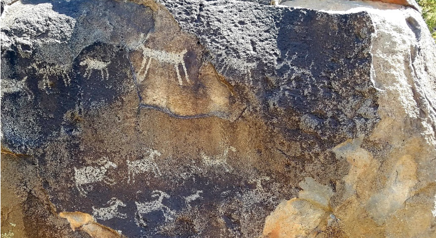
Big Arsenic Springs Trail is a more challenging 1-mile one-way, well-maintained footpath into the Rio Grande Gorge for stunning scenery. The trail starts on the mesa at the Big Arsenic Campground, where parking and port-a-potties are available. The trailhead is well marked and descends 800’ into the canyon via a series of downhill switchbacks. There are well placed informative interpretive signs about the area along the way – make a point to read them on the way back up the trail to provide planned stops that will break up the relatively steep climb to the top.
Once at the bottom, venture a quarter mile north upriver and the trail leads to an impressive display of petroglyphs from the people of the past that used to call this area home.
Rinconada Loop Trail is an easy, flat 5-mile-long trail (one way) at the top the rim of the Rio Grande Gorge. It’s a wide trail and has an all-weather surface; look for several signs once within the Monument indicating trail access.
Informative Guided Hikes may be available in the Rio Grande del Norte National Monument lead by Park Rangers. Stop by the Wild Rivers Visitor Center inside the Monument, open May to October, or call (575) 586-1150 for schedules and more information.
Directions to the Rio Grande Del Norte National Monument from the Questa traffic light.
Head north on NM-522 for 2.6 miles; look for signage for the Village of Cerro and the National Monument. Turn left/west onto NM-378 into Cerro; drive 3.5 miles through the winding community and just past the last residence a large sign marks the entrance to the Monument. The well paved road through the Wild Rivers section of the Monument is approximately 35 miles round trip.
Hikes In The Carson National Forest
Meadows, streams, wildflowers, and cool forests define these trails, and the Carson National Forest has a multitude of trails, here are some of our favorites. You can explore more hiking options at their website.
Columbine-Hondo Wilderness Area
Columbine Canyon is ten-minutes from the center of town, it’s a favorite moderate trail for short or long excursions. The Columbine Trailhead is well marked inside at the south end of the Columbine Campground (open for day use). The moderate trail follows Columbine Creek with several bridge crossings and open meadows of wildflowers.
Directions to the Columbine Campground/Trailhead from the Questa traffic light:
Drive east on NM-38 for 5 miles (toward Red River) looking for the wooden USFS Campground sign marking the entrance on the right/south side of the road.
Latir Peaks Wilderness Area
Cabresto Lake is 7 miles northeast of Questa with incredible scenery, the Lake Fork trail departs from the lake into the Latir Peak Wilderness Area. The moderate route is just under 5 miles one way; continue for another mile to Heart Lake for spectacular views from the ridge at Latir Lakes. The 15-acre lake and trailhead area offer picnic sites, excellent fishing, canoeing, a vault toilet, and nine first-come-first-serve no-fee tent-camping sites (no water).
Directions to Cabresto Lake/Cabresto Canyon from the Questa traffic light:
Drive east on NM-38 for 50 feet (toward Red River) and immediately turn left onto Cabresto Road behind the Visitor Center (if you miss it, just turn into and drive through the Visitor Center parking lot to reconnect with the road). Drive for 6 miles; along the way Cabresto Road changes names to NM 563 and then again to Forest Access Road 134. Turn left/north onto Forest Access Road 134A and continue on the winding road for 2 miles to the lake. 4WD or a high clearance vehicle is recommended.
Eagle Rock Lake Park
This family-friendly park is just 5 minutes from the heart of Questa, it’s popular for its 3-acre lake stocked with rainbow trout and its scenic walking path that circles the Lake. The Park has plenty of parking, picnic tables, is handicap-accessible, with a vault toilet.
Directions to Eagle Rock Lake from the Questa traffic light:
Drive east on NM-38 for 1.5 miles (toward Red River), Eagle Rock Lake is on the right/south side; look for the USFS sign at the entrance. Parking is plentiful.
Vistas De Questa Trail
This 4-mile moderate trail has a 500’ elevation gain with nice views and wildflowers, ending with a loop for the return journey.
Directions to Vistas De Questa Trail from the Questa traffic light:
Drive north on NM-522; at approximately 1.5 miles turn left/west on to Don Martinez Road. Continue for half a mile to the end of road and park in the small lot, the trailhead is the right.
Wild Earth Llama Adventures Guided Hikes
“Take a Llama to Lunch Day Hikes” and multi-day “Llama Trekking in the NM Wilderness” are both unique ways to enjoy an outdoor adventure; hikers and campers enjoy the surrounding area while the llamas carry all your gear!
(800) 758-LAMA
Questa History Trail
A Self-Guided Walking Tour
Take a walk back in time along the Questa History Trail. It’s a half-mile loop self-guided tour that can be walked or driven, featuring informative kiosks intentionally placed through town to share stories of the area.
The eight stops include information on the heritage and origins of the people; descriptions of the area’s unique geology and its significance to the Pueblo Indians and mining in the area; accounts of religious traditions and the restoration of Questa’s 1800s church, plus narratives that offer a peak into many other intriguing historic accounts.
Much more information can be found at QuestaTrail.org.
History Trail Maps can be found at the covered kiosk, which is the first stop, located on the property at the north-east corner of the Questa traffic light intersection; maps can also be picked up at Questa Visitor Center.
The Questa History Trail is a project of the Questa Creative Council. Complementing the history trail are oral histories cached online at QuestaStories.org by LEAP – Land, Experience, and Art of Place – a project of local non-profit Localogy.
Resources
Questa Visitor Center
1 NM-38 (at the Questa traffic light)
Questa, NM 87556
Open May to October and by appointment
(575) 586-2258
Wild Rivers Visitor Center in the Rio Grande del Norte National Monument
Managed by the US Bureau of Land Management
NM 378, Questa NM 87556
Open May to October
(575) 586-1150
USFS Carson National Forest Questa Ranger District Office
184 NM 38, Questa, NM 87556
(575) 586-0520
Wild Earth Llama Adventures guided hikes
(800) 758-LAMA (5262)
New Mexico Game and Fish
For comprehensive information on fishing and hunting, including calendars, licenses, permits, maps, and all rules and regulations
(888) 248-6866
www.wildlife.state.nm.us/